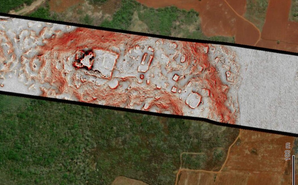
 In this composite image, topographical data from a lidar survey is superimposed over the green forest canopy it surveyed, revealing how easily it is to hide even dramatic buildings in the jungle, and how easy it is for lidar to find them – Photo courtesy Luke Auld-Thomas.
A major Mayan urban center has been found in a recent lidar survey on the Yucatan Peninsula that includes pyramids and ball courts.
The archaeologists triumphantly declare that the world is yet far away from the last major discovery under the jungles of Central America.
The survey was published in a recent study wherein the authors sought to answer a simple question: was the Mayan Lowland densely populated, or does it merely seem that way because of the collection of famous sites located there?
Lidar is an aerial survey tool that uses laser pulses to measure distances. It allows archaeologists to create detailed 3D topographs of forest area quickly whilst completely removing the trees from obscuring the view below, and as such has revolutionized archaeology in South and Central America.
Researchers avilaing themselves of lidar’s powers have shown that “low-density urbanism” is widely spread around many parts of Central and South America, where tens of thousands, even millions of inhabitants lived in collections of sophisticated settlements centered around keystone structures like the pyramid in Tikal or Tulum.
But doctoral student Luke Auld-Thomas and Francisco Estrada-Belli, a research professor in Tulane’s Department of Anthropology, wanted to test just how densely-populated the Mexican state of Campeche was during the Mayan Classical Period (250 CE – 900 CE) by essentially picking several survey plots in the state’s unexplored southeastern forests at random.
What they found is proof of what many of the most radical historians and archaeologists in the world are now proposing: that low-density urbanism in tropical forest was widespread across the continents.
“We didn’t just find rural areas and smaller settlements. We also found a large city with pyramids right next to the area’s only highway, near a town where people have been actively farming among the ruins for years,” said Auld-Thomas to his university press.
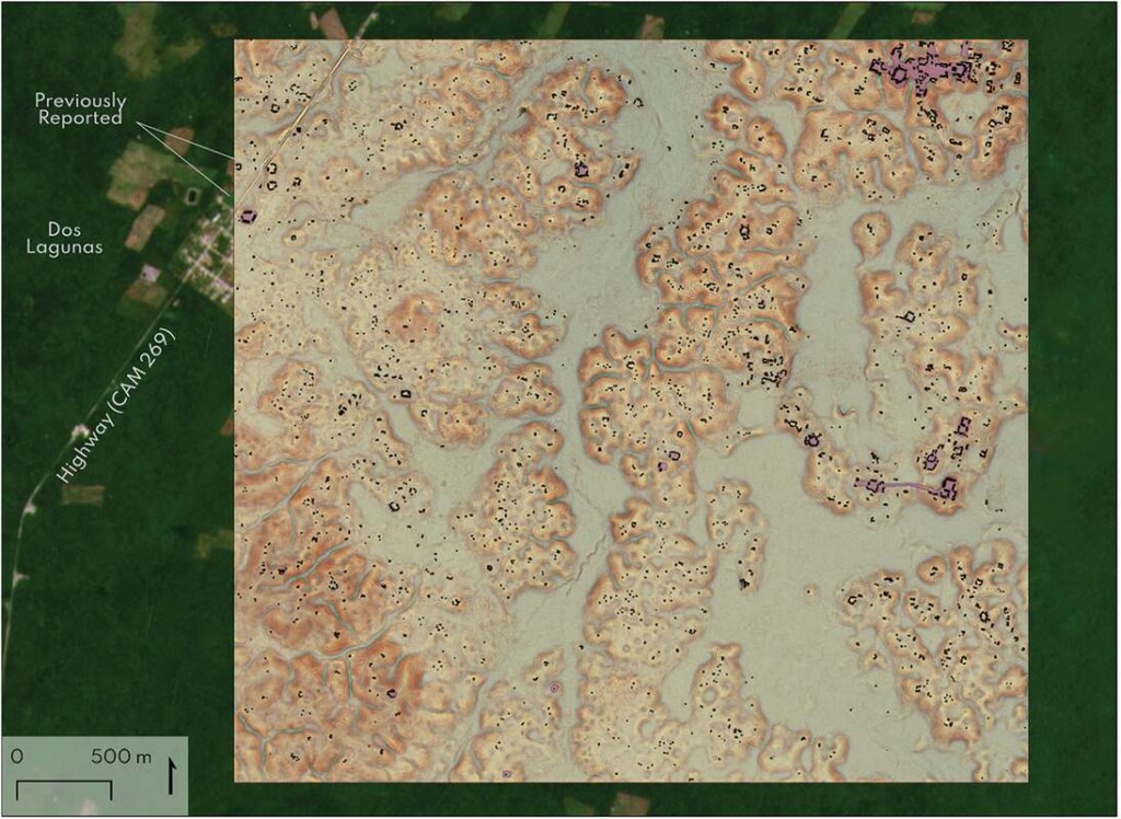
 The most populated survey area, with the city of Valeriana to the northeast corner – credit, Auld-Thomas, Canuto, et al.
“The government never knew about it; the scientific community never knew about it. That really puts an exclamation point behind the statement that, no, we have not found everything, and yes, there’s a lot more to be discovered.”
6,500 pre-Hispanic structures, including both habitation and landscape elements, were turned up across 5 survey blocks of about 50 square miles, or about 32,000 acres.
The city was dubbed Valeriana by the authors of the study, who note that none of the structures, to their knowledge, have ever seen archaeological fieldwork. As such, the number of buildings may be less, though the authors add that never has the number of sites in a lidar survey been subsequently reduced after field excavations—the technology has a robust track record of accuracy.
LEARNING TO LOVE LIDAR:
“The larger of Valeriana’s two monumental precincts has all the hallmarks of a Classic Maya political capital: multiple enclosed plazas connected by a broad causeway; temple pyramids; a ballcourt; a reservoir formed by damming an arroyo; and a probable E-Group assemblage, an architectural arrangement that generally indicates a founding date prior to [150 CE]” the authors describe.
Settlement and agricultural infrastructure completely fill the 4,000 acre survey area, dominated by landscape engineering spilling over the topography to the south and west.
“Lidar is teaching us that, like many other ancient civilizations, the lowland Maya built a diverse tapestry of towns and communities over their tropical landscape,” said Professor Marcello A. Canuto, advisor to Auld-Thomas, and co-author on the study.
“While some areas are replete with vast agricultural patches and dense populations, others have only small communities. Nonetheless, we can now see how much the ancient Maya changed their environment to support a long-lived complex society.”
SHARE This Unbelievably Important Discovery On Social Media…
Source link

