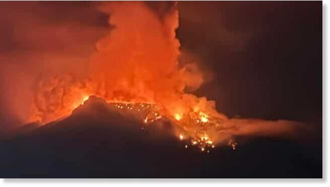
Indonesia's Ruang Volcano
The eruptions at the Ruang volcano occurred multiple times since Tuesday (Apr 16). As the magma rose to the surface and erupted, it produced various volcanic materials, including lava flows and ash clouds. The delicate situation prompted the authorities to elevate the alert level to the second highest.
Heruningtyas Desi Purnamasari from Indonesia's Center for Volcanology and Geological Hazard Mitigation (PVMBG) reportedly told Reuters that recent earthquakes on the island triggered the eruptions. This resulted in the emission of dangerous "explosive hot clouds" reaching heights of 1.8 km.
"We must clear the island because we anticipate there could be more eruptions. No activity is allowed within four kilometres from the crater," Purnamasari said.
Footage which is doing the rounds on social media platforms depicted the red lava flowing down the mountain. It cast hues of crimson and gold across the sky and the waters below. Moreover, plumes of smoke billowed in the skies as the molten fury continued to brew from its crater.
Ruang Island, also known as Pulau Ruang in Indonesian, is a small island located in the Riau Islands province of Indonesia.
It is home to around 838 residents and is part of the Riau Archipelago, which consists of islands scattered across the between Peninsular Malaysia and the island of Sumatra.
The majority of the evacuations took place on the nearby island of Tagulandang.
Pacific Ring of Fire
Indonesia lies within the Pacific Ring of Fire and this makes it one of the most seismically active regions in the world.
This geological phenomenon is due to the movement and interaction of several tectonic plates beneath the Earth's surface. Indonesia sits at the convergence of several of these tectonic plates, including the Pacific Plate, the Indo-Australian Plate, and the Eurasian Plate, which are constantly in motion. The collision and subduction of these plates create volcanic activities.
Source link

