
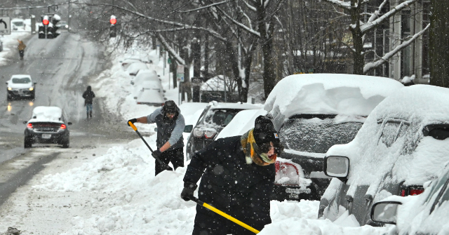
A huge winter storm is expected to wallop the East Coast Sunday into Monday, and over 40 million Americans are bracing for impact.
The nor’easter was forecast to drop heavy snow on the I-95 corridor, prompting officials with the National Weather Service (NWS) to place southern Delaware, the Jersey Shore, New York City, Long Island, and the Connecticut coastal area under a blizzard warning, ABC News reported Saturday.
In a social media post on Friday, the NWS described nor’easters as “Winter’s Fury.”
“Not many storms have the potential the bury 100 million in 1-2 feet of snow in a single day. Nor’easters are notorious for packing big wind and copious amounts of moisture they get from the Atlantic. The heavily populated region between Washington, DC, Philadelphia, New York, and Boston, the ‘I-95 Corridor,’ is especially impacted by Nor’easters,” the post read:
You're likely to hear the term "Nor'easter" in the coming days as a coastal storm develops this weekend.
— National Weather Service (@NWS) February 20, 2026
Nor’easters are notorious for packing strong winds and copious amounts of moisture they get from the Atlantic. The heavily-populated region between Washington D.C.,… pic.twitter.com/EpPRaU1B4j
Forecasters said there could be more than a foot of snowfall and gusty winds as the storm moves through the area.
There is also a warning about possible coastal flooding and erosion, per Fox Weather:
❄️ HISTORIC SNOW STORM : FOX Weather Meteorologists Michael Estime and Nick Kosir break down how serious the coastal erosion threat can be as a result of this historic nor'easter set to slam millions this weekend. Stay with FOX Weather for the latest:@NickKosirTV… pic.twitter.com/NXrPoGw6cN
— FOX Weather (@foxweather) February 21, 2026
The Weather Channel named the system Winter Storm Hernando, noting peak snowfall should occur Sunday and Monday.
“We expect low pressure to form Sunday off the East Coast, somewhere offshore between the Delmarva Peninsula and the Carolinas,” the outlet said, adding, “That low pressure should quickly gain strength, and could do so quickly enough to be called a ‘bomb cyclone’ by early Monday, a term for low pressure that intensifies rapidly.”
3RD CALL SNOW MAP ❄️🚨 — MORE UPGRADES IN THIS WEATHER PACKAGE
— Mike Masco (@MikeMasco) February 21, 2026
BLIZZARD WARNING for the NJ Coast, NYC, Long Island & Southern CT
This storm has trended into a fully phased and rapidly intensifying coastal low, allowing for extreme upward motion (strong lift) as the system… pic.twitter.com/ySPDunFf6k
Meanwhile, the New York Post pointed out that residents had just begun digging out of severe winter weather and are waiting for the blizzard to hit.
AccuWeather senior meteorologist Carl Erickson told the outlet the storm will bring strong winds and near-blizzard conditions, making travel dangerous.
“The worst of this storm will be overnight Sunday and into Monday morning. That’s when we expect the core of this nor’easter,” he said, explaining the snow will start tapering off past daybreak on Monday.